Blue Nile Falls
Blue Nile Falls
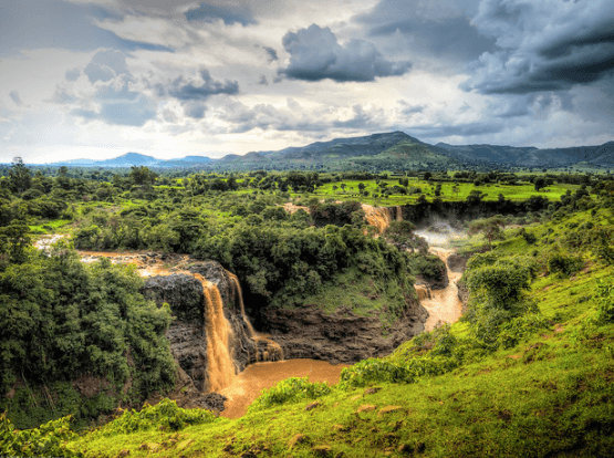
Some 30 km from Bahir Dar, Tis Abay Falls mark the birth of the Blue Nile, with a stone bridge from 1626 still standing nearby.
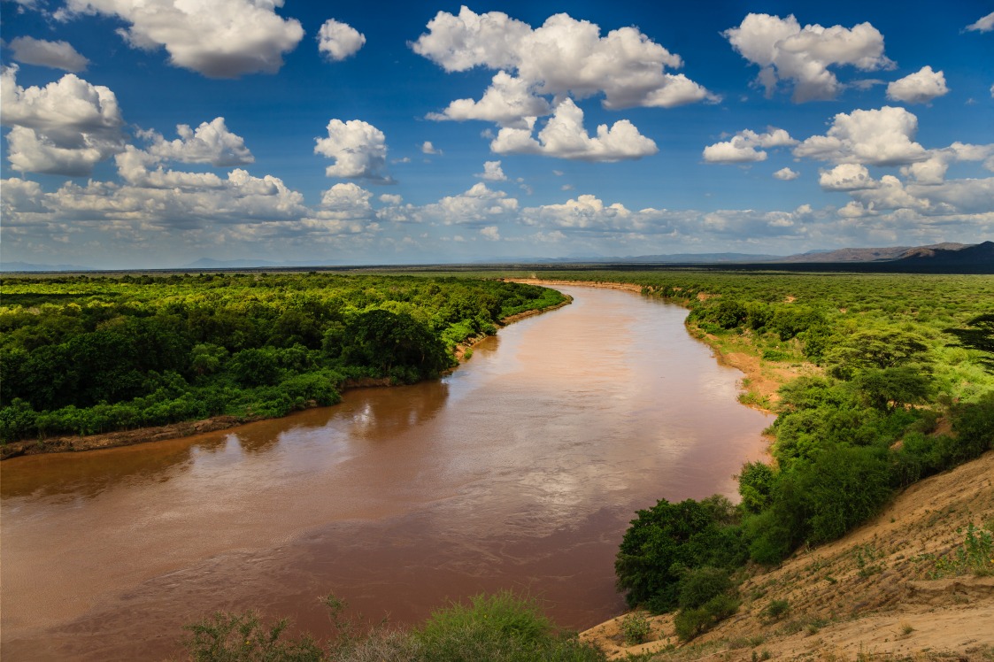
The Blue Nile Falls, known as Tis Abay in Amharic ("great smoke"), are located in the Amhara region, about twenty kilometers southeast of Bahir Dar and Lake Tana. Standing roughly 40 meters high and sometimes 400 meters wide during the rainy season, they mark the exit of the Blue Nile from Lake Tana, the origin of one of the two major tributaries of the Nile.
Why visit the Blue Nile Falls
The site combines three complementary attractions. Geographically, you can witness the birth of the Blue Nile shortly after its exit from Lake Tana, before its long journey toward Khartoum, Sudan, where it meets the White Nile to form the Nile, a river of 6,700 kilometers. Naturally, the waterfall sits within a landscape of plateaus and hills characteristic of northwestern Éthiopie. Historically, a stone bridge built in 1626, considered the first stone bridge in Éthiopie, still stands spanning the river in close proximity.
History of the site
The bridge near the waterfall was constructed in the 17th century, during the period when the Lake Tana region concentrated Ethiopian power around Gondar and successive imperial courts. The structure, attributed to Portuguese influence present in the country at that time, enabled crossing of the Blue Nile along one of the principal trade routes connecting the highlands to the north of the country. Still standing today, it remains one of the oldest stone bridges in sub-Saharan Africa.
The falls themselves long served as a landmark for explorers seeking the sources of the Nile. From the 18th century onward, British explorer James Bruce describes them in his travel narratives, contributing to their place in the European geographical imagination linked to the great African river.
What to see and do on site
- The waterfall: its flow and width vary greatly by season (from a trickle in the dry season to a curtain 400 meters wide at the height of the rainy season).
- The Portuguese bridge of 1626: a few minutes' walk from the waterfall, still passable by foot.
- Hiking trails: a loop circuit connects the starting village, the bridge, several viewpoints of the waterfall, and a passage by boat on the river.
- Surrounding villages: you'll encounter typical rural life in the Amhara region, centered around small agricultural holdings.
When to visit
Your choice of season shapes the experience. From July to September, the rainy season swells the flow; the falls reach their maximum width and most spectacular power, though trails can be muddy and water particularly turbid. From October to February, skies are clear, trails passable, and flow still respectable: this window offers the most balanced experience. In prolonged dry season (March–June), flow is greatly reduced, compounded by withdrawals from the hydroelectric station upstream.
Practical information
- Duration of visit: allow 2 to 4 hours on site, including the approach walk and complete tour of the area.
- Difficulty: dirt trail, some uphill stretches, accessible to anyone in normal condition; closed-toe shoes recommended.
- Entry fee: paid entry to the site, moderate amount; a local guide can be hired on-site.
- What to bring: water, sun protection, rain jacket in humid season, and a lens protector if photographing through mist.
How to get there
The starting point is Bahir Dar, the main city in the Amhara region, served by flights from Addis Ababa. From Bahir Dar, two options: a private vehicle or shared minibus to Tis Abay village (approximately 30 km, 45 minutes to 1 hour depending on road conditions), then 20 to 30 minutes' walk to reach the viewpoints. Half a day from Bahir Dar is enough to make the round trip comfortably.
What to combine in the region
The falls naturally pair with Lake Tana and its island monasteries, accessible by boat from Bahir Dar. The lake is home to more than 67 fish species, of which approximately 70% are endemic, making it a major ecological site. Further north, the Debre Birhan Selassie Church in Gondar enriches an itinerary in the region nicely, as does the Abreha Atsbeha Church in Tigré for travelers continuing northward. At the opposite end of the country, the Danakil Desert offers a striking geological contrast.
Frequently asked questions
Frequently asked questions
For maximum flow, aim for the tail end of the rainy season (August–September). For a balance between decent flow and pleasant walking conditions, October through February remains the most recommended period.
Yes. The dry season naturally reduces flow, and the hydroelectric station installed upstream withdraws a portion of the flow year-round. In prolonged dry season, the waterfall can diminish to a few streams.
Half a day is sufficient: approximately 1 hour's drive in each direction, plus 2 to 3 hours on-site to complete the loop, see the 1626 bridge, and visit the main viewpoints.
Yes, the bridge still stands and is passable on foot. It forms part of the marked circuit around the waterfall and serves as a historical complement to the natural site.
Swimming in the pools downstream is practiced outside periods of high flow, but requires caution: currents, turbid waters during rainy season, and risk of schistosomiasis in stagnant pools. Consult your local guide.
Plan your trip
The Blue Nile Falls naturally fit into a northern Éthiopie circuit linking Bahir Dar, Gondar, and the Simien. To build a custom itinerary, explore our journeys in Éthiopie.
Interested in this visit?
We can include it in your personalised itinerary.