Great Rift Valley (Éthiopie)
Great Rift Valley (Éthiopie)
A tectonic fracture stretching across Éthiopie for over 1,000 km, the Great Rift Valley aligns alkaline lakes, active volcanoes and spectacular wildlife between Addis Ababa and Arba Minch.
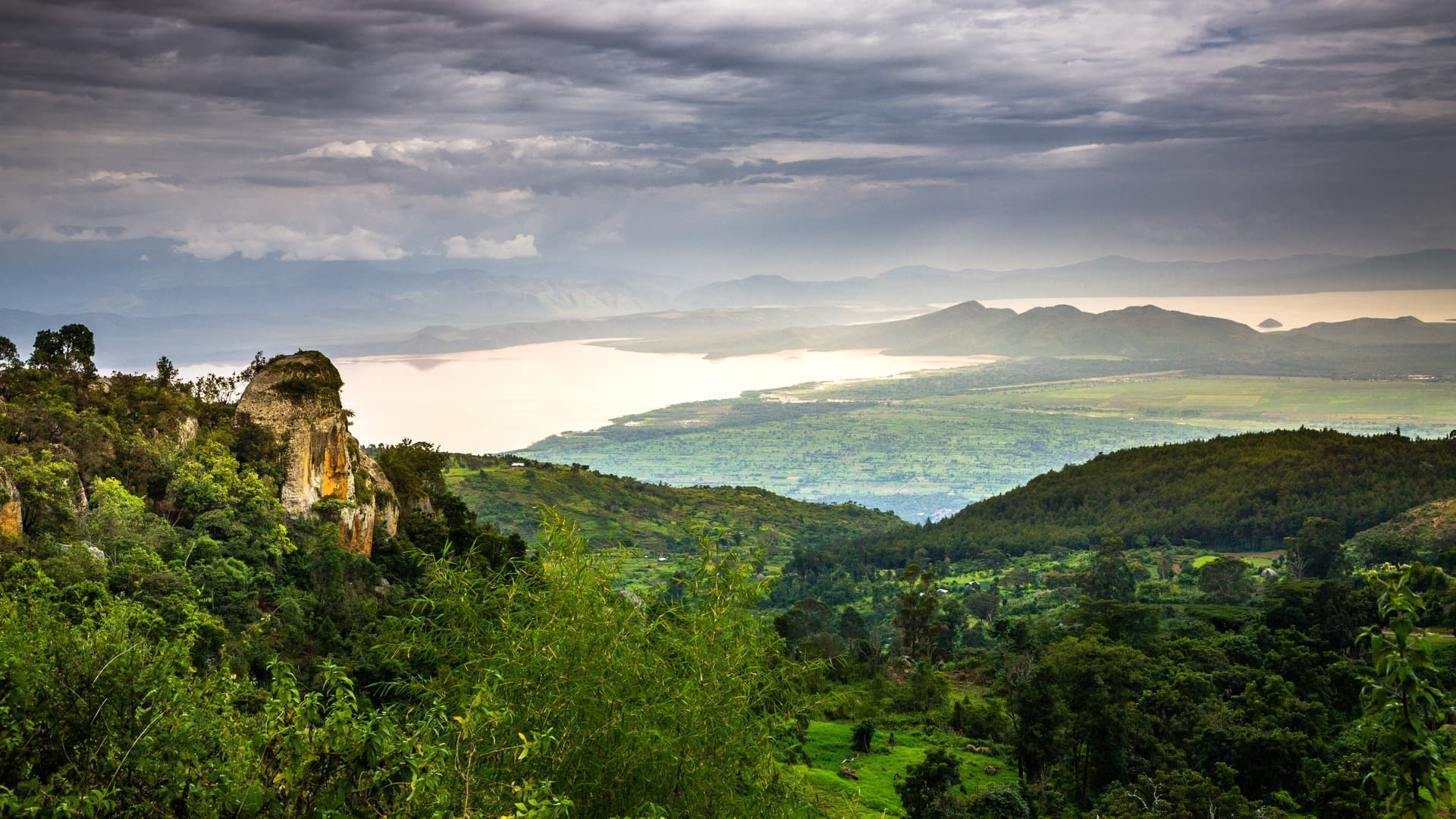
The Great Rift Valley traverses Éthiopie from northeast to southwest over more than 1,000 kilometers. This major tectonic fracture shapes a landscape of alkaline lakes, volcanoes, hot springs and savannas populated by pink flamingos and pelicans. It is one of the rare places in the world where geology, wildlife and ancient human cultures can be read simultaneously on the same horizon.
Practical Information at a Glance
- Access: the most visited portion extends south of Addis Ababa, accessible by the main road toward Hawassa and Arba Minch.
- Recommended duration: 3 to 7 days to cover several lakes and parks; one day is enough for an overview from Addis Ababa (Lake Ziway or Lake Langano).
- Attire: light clothing, hat and sun protection essential; boots or closed-toe shoes for volcanic zones.
- Entrance fees: each national park or reserve applies its own entry fees; plan to carry cash in Ethiopian birr.
What to See There
The Éthiopie Rift aligns a series of lakes with very different characters. Lake Awassa welcomes hippopotamuses and kingfishers just meters from the shoreline. Lakes Abiata and Shalla, within the eponymous national park, attract colonies of pink flamingos. Lake Langano, with its brown-reddish waters, is one of the rare Rift lakes reputed to be free of bilharzia, making it a popular swimming spot.
Further south, lakes Abaya and Chamo border Arba Minch. Lake Chamo is known for its populations of Nile crocodiles and hippopotamuses, observable by boat. The caldera of the Shala volcano, with its hydrothermal springs, illustrates the geological activity still present.
History and Context
The Rift is an active tectonic boundary: the African plate is slowly dividing, and eastern Éthiopie is drifting toward the Red Sea. This dynamic created conditions conducive to the emergence of humanity: it was in the Éthiopie Rift and its surroundings that some of the most ancient hominid fossils were discovered, including Lucy (Australopithecus afarensis), unearthed in 1974 in the Afar Depression.
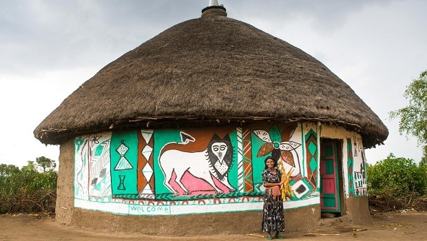
The shores of the lakes have been inhabited for millennia by peoples such as the Oromo, Sidama and Guji, whose agropastoral practices shaped the riverside landscapes.
Highlights of the Visit
Lake Awassa and Its Fish Market
Each morning, fishermen bring their catch ashore at Lake Awassa. Marabous and pelicans compete for scraps just meters from the market stalls. The scene is loud, aromatic and photographically intense.
Abiata-Shalla National Park
Pink flamingos gather by the thousands on the alkaline shores of Lake Abiata depending on the season. Lake Shalla, deeper, is surrounded by cliffs and fumaroles. The two lakes are separated by a narrow strip of land.
Lake Chamo and the "Crocodile Nursery"
A boat excursion on Lake Chamo allows you to approach sandbars where large Nile crocodiles bask. Local guides know the concentration zones; book the outing early in the morning.
Hot Springs of Lake Shalla
On the shores of Lake Shalla, hydrothermal springs gush at high temperature. Local inhabitants cook eggs in them; the steam and colored mineral deposits offer a striking geological spectacle.
Photography Tips
Golden morning light is ideal for photographing flamingos and fishermen. Avoid midday: the glare on alkaline lakes overexposes images. A telephoto lens (200 mm minimum) is useful for wildlife without disturbing it. Check restrictions in each park before deploying a drone.
Location and Access
The southern portion of the Éthiopie Rift begins about 250 km from Addis Ababa. The asphalt road to Hawassa is passable by ordinary vehicle. Arba Minch, the access point for lakes Abaya and Chamo, is served by domestic flights from Addis Ababa. Minibuses connect the main towns of the Rift, but renting a vehicle with driver remains the most flexible solution for chaining sites together.
Surroundings
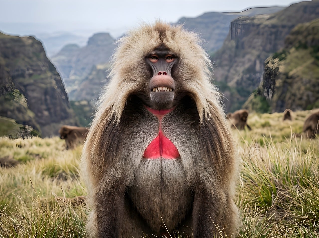
- Siemen National Park — mountainous massif to the north, habitat of the gelada and the Éthiopie wolf.
- Lalibela — medieval rock-hewn churches carved into stone, away from the Rift but essential in any Éthiopie itinerary.
- Addis Ababa — capital and natural gateway to the southern Rift, with the National Museum housing Lucy's fossil.
- Bale Mountains National Park — highland forests and afroalpine savanna east of the Rift, refuge of the Éthiopie wolf.
Frequently asked questions
The dry season (October to February) offers the best conditions: passable roads, wildlife concentrated around water points, clear skies. The long rainy season (June-September) makes some tracks difficult but greens the landscapes.
Lake Langano is traditionally recommended for swimming as its alkaline waters are reputed to be free of bilharzia. Other alkaline lakes (Abiata, Shalla) are not suitable for swimming. Check with your local guide before any contact with the water.
A local guide is mandatory in most Éthiopie national parks and strongly recommended for boat excursions on Lake Chamo. It also facilitates exchanges with riverside communities.
A 5 to 7-day circuit from Addis Ababa allows you to cover lakes Ziway, Langano, Abiata-Shalla and reach Arba Minch. An additional week opens the road to the Omo Valley and its southern peoples.
Minibuses connect Addis Ababa to Hawassa and Arba Minch. To access the lake shores and parks, a private vehicle or rental car with driver is necessary: the parks are not served by public transportation.
Yes. The southern Rift naturally combines with the Omo Valley (peoples with ancestral traditions) to the south, and with Addis Ababa to the north. Lalibela and Siemen require an additional domestic flight but fit into a two-week circuit.
Interested in this visit?
We can include it in your personalised itinerary.